Cartographer of “Songs of Ice and Fire” John Roberts (Jon Roberts) in his blog told how to draw a map of the city correctly. It seemed to us that this topic might be interesting, including for mobile game developers, and we translated the material into Russian.
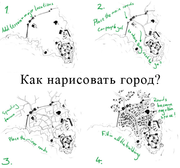
This is neither a photoshop tutorial, nor a guide to creating a polished finished map. This is a step-by-step demonstration of my method for creating cities when I make the first sketch.
The main thing is that the city map should be logical.
- Draw the terrain and the most important locations
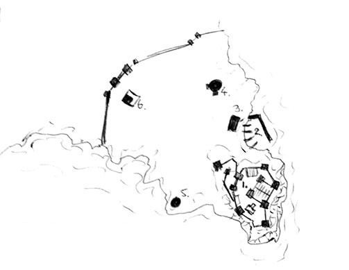 The city depends on the area. Therefore, the first thing to do is to draw the terrain on which the city is spread. As an example for the material, I decided to draw a city located on a deeply protruding cape. The coast, except for the bay in the Northeast, is rocky and broken.
As soon as you have sketched the landscape, go from it at the location of the main buildings. We put the castle on a hill with an open view of the sea and the land around. The cliffs framing the hill serve as a natural line of defense. Any attack from the land is possible only down the peninsula. It is clear that the city, first of all, will want to protect the harbor, so it would be logical to put up a wall completely covering the peninsula from the rest of the land.
After I put up the main defense, I added a port for fishermen (food) and a market near the docks (commerce). I also put up several large buildings – 4,5 and 7, which can be a temple, a tavern and a wizard’s tower, respectively – these are the three most important locations in any fantasy city.
- Mark the main roads
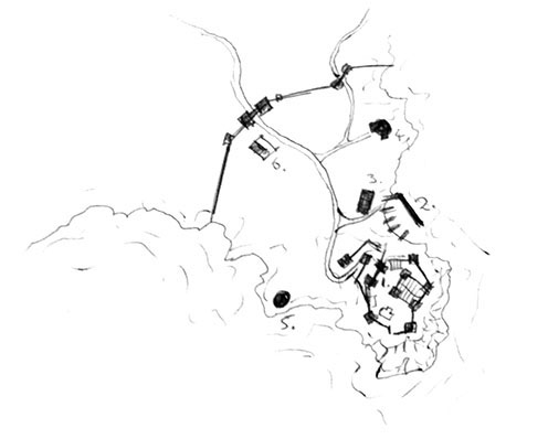 Roads get people where they need to go. In this case, the road should be a fairly direct route from the main gate to the castle. Remember that roads follow the contours of the terrain. Avoid straight roads in fantasy city maps – it is assumed that there are no earthmoving equipment in such cities, so roads constantly bypass obstacles. This will help give the city the appearance of a naturally grown settlement.
Once we have laid out the main artery, draw the main roads to the food source and commercial points – these will be the busiest routes. Also add a couple more lines. For example, I drew a road leading to the Northeast, to the second gate.
- Sketch out minor roads
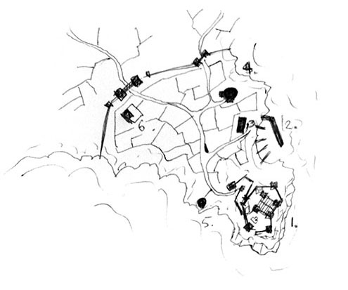 The map of the city with only the main roads looks empty. Add a network of small trails to fill the space. Remember that most small roads should take people to the main roads. Add bends and corners to them to make them look more interesting and, of course, take into account the terrain.
- Embed in the house map
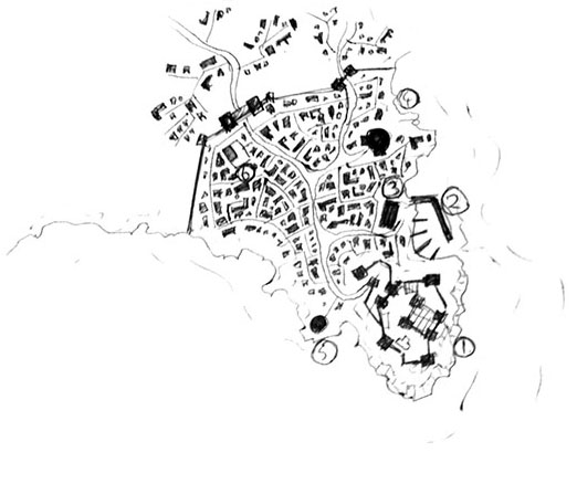 It may take some time. It all depends on the scale of the map and its details. I drew this sketch on paper of the order of two square inches (5 cm 2), so the buildings could be something like dots. So here the buildings are presented in the form of blocks grouped in the space between the roads. Ideally, when you finish drawing houses, you should see roads, even if you remove the lines that marked them.
That’s all. You have finished your sketch. Add the keys to it – and it will be a full-fledged functional map of the city.
A source: http://www.fantasticmaps.com/2013/03/how-to-design-a-town/